Thursday, June 23, 2005

Aaron River Reservoir (Hingham MA)


When We Went:

Late June 2005. It was another after work adventure. This one didn't turn out as planned, but was interesting.

Description:


The Aaron River Reservoir is part of the Wompatuck State Park which is located in Hingham, MA. Aaron River Reservoir is actually a reservoir for Cohasset, MA. From looking at their mass Department of Recreation Web Site, one would think that Kayaking was allowed and promoted at the reservoir. It appears not to be the case, but we'll get to that in a little while. The state park has a main entrance in the north western corner. This road (Hingham's Union St) appears to connect to a number of smaller roads. It does in fact connect to these roads, but none of them are open. They are all closed off to motor vehicle traffic.

When we arrived at the roads that connected Union St to the main road we decided that it was too long of a walk to carry our Kayaks, so we decided to walk to the Reservoir to check it out for next time. This was a long, and very buggy walk. It was about a mile in each direction. The mosquitoes were ferocious.

Along the road we met a park ranger on a bicycle, asked about the reservoir, and were told that only "flat bottom" boats were permitted. She said Kayaks and Canoes were not permitted. This made the trip to the park particularly given the text on their web site "Fishing is allowed in the Cohasset Reservoir. A boat ramp is provided for car-top boats, but no boat trailers, please." and under Recreational Opportunities both "Nonmotorized boating" and "Boat Ramp" are listed.

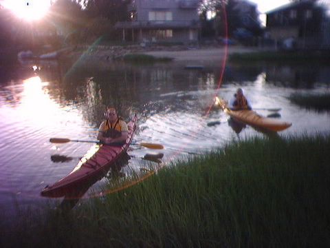
When we did get to the reservoir it looked very nice. Very clean water as you would expect, and looked like some interesting terrain, some houses on hills above the water, and lots of shoreline. We also found a small pickup truck parked at the boat ramp and were left wondering how they got the truck in there given all the gates off the main road we saw were closed. Just another fustration to add to the list.

Needless to say we plan on calling the Park and understand their rules better than the quick conversation with the ranger on the walking trail (781 749-7160) if you are interested.
That said, we are not overly excited at the moment about returning. The issues are 1) The Long walk would require wheels for our Kayaks to allow us to roll them / carry 1/2 of their weight instead of carry them outright which wouldn't be practical 2) the bugs were just ridiculous and 3) the ranger either not knowing what Kayaks are or the website is wrong and we can't Kayak there at all..

Put In Details:

The put in area was nice, had space for a few cars to park, and offered what seemed like a nice area to get in with a gentle slope. The problem is access to the area is extremely long walk to carry of cart your Kayaks. Maybe a update will be in order if we contact the Park and see if there is a way that we can drive in to the boat ramp. This would really change the complexion of the access to the Reservoir.

Link to Map:

The DOR website provides a nice map of the park itself. Here is a link: http://www.mass.gov/dcr/parks/trails/Wompatuck.gif. The map is a little misleading in that Union St. Does not connect to the local roads at the south entrance. The road is blocked by another of the infamous gates.

Here is a link to Google's MAP of the area. http://tinyurl.com/ak697

.


Monday, June 20, 2005

Whitmans Pond (Weymouth MA)

When we went:

Late June 2005. It was after work, but we had a hour and 1/2 of daylight to work with. It was a nice clear night and a good sunset. It was hotter earlier in the day, but cooled off nicely.

Description:

Whitman pond is located in Weymouth, MA. It is one of our favorite after work locations. We went there a few times last season. It is a big enough lake that there is quite a bit to explore, but close enough to home and accessible enough to make it a no hassle location for going kayaking.

The lake has a few different sections and a large island in the middle to explore. There are lots of different houses along the shore to look at also some undeveloped sections. There is some construction going on over near the route 53 end of the lake, some condos are being built close by.

We ended up not going too far away from the Middle street launching area. We had a 3 new kayakers with us. Each took a turn in one of our Kayaks. It was a very successful first trip for them, and fun for us.

There are some power boats on the lake, but most are respectful and have either steered clear of where we were or slowed down so that their wake was not an issue. We've seen other kayakers and people canoeing on the lake. Typically there are always a few people fishing from the shore (normally at the park, but at the opposite end from the the boat ramp area) and a few people fishing from canoes or small power boats.

Put in Location:

There is a nice boat ramp with a good parking area and small park along middle street in Weymouth just north of Lake Shore Drive. The shoreline is not steeply sloped and there is plenty of area to get into the water.

Link to Map:

http://tinyurl.com/bsy57

Picture:


A picture of the lake from 2002 the put in area is on the north shore of the peninsula in the middle of the picture.


Sunday, June 19, 2005

Weymouth Back River (MA)


When We Went:


Middle of June 2005. We had been here before. The previous summer. That first trip was an interesting lesson..... More on that in a bit. Let's review this year.

Picture:


Description:

We went on a Sunday afternoon, night almost. It was still daylight, and we wanted to get in a quick Kayak. After forgetting the paddles at home, running back quick we gave the kayaks a quick workout. Nothing glamorous, just a nice paddle around the Back river area. The tide was coming in which was a good thing, and it was getting dark quickly.

The Weymouth Back River connects Great Esker park (in Weymouth MA) and Bare Cove Park (In Hingham, MA) to the ocean. We launched from Abigail Adams Park in Weymouth. It is a fairly new town park that also serves as the parking lot for a yacht club. Not sure how that works, but regardless a nicely sloped rocky beach is about a 50 foot walk from a nice new parking area. There is a walking path around the park and nice benches and landscaping.

The last time we were there we here we didn't really understand the concept of tides. We went out for the afternoon and so did the tide. After going out toward the ocean (through the boat yard, which is a very interesting place to kayak, nice big boats to look at, not too much wake because everything is going slowly....), we came back to a shoreline that had receded about 50 feet. Needless to say, walking through mud and muck that is 'way' up over you knees is something that makes you observant of the tides next time.

We still haven't made it inland from the 'put in' area, Great Ester Park, but next time, when we have more daylight left it is definitely in our plans.. Just need to make sure to get a tide schedule.

Put in Location:

Access from a few places are possible, but we find Abigail Adams park on 3A is a good spot to put it. As you drive along 3A going East it is across from Lowes, there is a jug handle right after that AppleBees that lets you cross over 3A and enter the park's driveway. If you are coming west it is just after the bridge from Hingham to Weymouth (right after the Dodge Dealer).

Link to Map:

http://tinyurl.com/cgxuq


Monday, June 13, 2005

Charles River (Newton MA)


When We Went:


Before we purchased kayaks we were looking for a place to rent them to give it a try. Charles River Canoe and Kayak provided us the perfect opportunity. We went a number of times both before and after we bought our Kayaks. Likey during the summer of 2002 and 2003, but it is hard to remember exactly...


Details:

CRC&K rents Kayaks and Canoe's by the hour or the day. They include paddles and PFDs, everything you need to give it a try.

They have a large facility in Newton, MA on the Charles River. If you go south from their location you can go all the way to the Dam in downtown Waltham (Moody Street). If you go North from there you can go quite a way as the Charles gets twisty

This part of the Charles is very nice. There are lots of things to look at and more than enough room to tire yourself out going either down river to Waltham or up river toward Wellesley and Newton. Going under the highways (Mass Pike and Route 128) is quite interesting, but loud. Going down river towards the damn at Waltham is the more interesting direction.

There aren't alot of things for people who aren't kayaking to do, save renting a Kayak or Canoe and coming along. This can easily be a 1/2 day trip so pack some water and munchies.

Put In Details:

There are a few parking spots at CRC&K, but the majority of the parking for Charles River Canoe and Kayak is actually in a public lot located across the river. In this same parking lot we've launched our own Kayaks quite easily. There is a staircase that goes up to the Route 30 overpass that has a walkway over to the CRC&K location.

Getting to the intersection of Route 128 (route 95 for those of you who don't count yourselves as locals) and Route 30 is easy from where ever you are in MA. Understanding exactly where to get off both the Mass Pike and Route 128/95 to get to route 30 is interesting.

Link to Map:
The parking lot and Put-in area are at the southern end of Norumbega Road.

http://tinyurl.com/9nowk


Saturday, June 11, 2005

Walden Pond (Concord MA)


When we Went:


We went to Walden Pond during the summer of 2003. On Walden Pond, Thoreau, Walden Pond Lives up to the history.


Description:

Walden Pond is located in Walden Pond State Reservation. It is an ideal location to go Kakaking if you want to go somewhere for the day or afternoon with others who aren't going to be kayaking, or if you are sharing kayaks. It is a great place to go kayaking, swinning, or to go for a walk/hike on the trails that surround the pond. It also has a nice picnic area.

When we went we were a bit uncomfortable with all the swimmers in the lake. We did enjoy the lake, exploring the shoreline, and the convenience of being so close to Boston.

Here is a Link to the homepage for the Walden Pond State Reservation on the Mass Department of Conservation and Recreation http://www.mass.gov/dcr/parks/northeast/wldn.htm.

Put In:

Walden Pond has a great boat ramp area and parking area. It is adjacent to the swimming area at the entrance to the pond area. From what we remember there was an admission fee for using the boat ramp area, but nothing more than 5 dollars or so. There were quite a few friendly Kayakers there.

Trail Map:


Location / Directions:

Walden Pond is located off of Route 2 and Route 126 in Concord MA. If your coming from the East take the exit for Route 2 off of Route 95.

Link to Map:

http://tinyurl.com/cof6r


Friday, June 10, 2005

Spy Pond (Arlington MA)

When We Went:

We went to Spy pond many times over the spring, summer, and fall of 2003. It was a great after work location. It was convenient to Rt 2 and located just off of Mass Ave in Arlington, MA.

Description:

Spy pond is the perfect size. You can take your time and get around the entire lake in a hour and 1/2. There is a parking lot, very nice playground, picnic tables and a good size parking lot. The Spy pond park area is along the old railroad tracks (never built, but that's unrelated) that are now the Arlington bike path.

The lake is mostly surrounded by houses, but one section of it is next to Route 2. The cars on Rt 2 can actually be pretty loud as they zoom past that section of the lake, but it's a good encouragement to go quickly along that section.

This is actually the place where we took our Kayaks for a test drive before buying them. We've seen quite a few other Kayakers there. We've also seen kayak water polo being played there. The people playing all had the smaller white water kayaks. It was very entertaining to watch.

This is a great lake to take people on if they are just learning. Wild Women Outfitters used to be just a few streets away, but we recently heard they were closing. It is really too bad, they were very helpful.

Web Link:

Spy Pond Web Site

Put-in Details:

The put-in we've used a number of times is on Pong Lane just off of Mass Ave. If you are coming south it's a right turn just after the light by the fire station (at Franklin Street). There is another parking area in the same park area off of Linwood Street.

Link to Map:

http://tinyurl.com/9spca


Thursday, June 09, 2005

Upper Mystic Lake (Medford MA)


When We Went:


We went to Upper Mystic lake during the summer and fall of 2003.

Details:

Upper Mystic Lake is part of the Mystic River Reservation. The Upper lake is for non-powerboats only. There are many houses along one side of the lake. They had nice lawns and made for a interesting view. At the north end of the lake there was a stream / small river that fed the lake. We went up the river as far as we could, likely a few hundred yards, before small trees that had fallen blocked our path. There was a small road overpass and some other interesting turns to navigate.

Also on the north side of the lake there was a nice marina. Likely this could be a second put in area, but we never explored it by car to see if it was open to the public etc. (see put in info below).

The lake was very nice. The water was clear and there were no powerboats or large waves to deal with. The lake was a very good size, large enough to give you a nice workout going from the southern part to the northern part and back.

Put In:

The Mass PAB provides a great list of put-in locations, each with a PDF file that details the area. This is something I just found. It's a great resource! The Put in area for Upper Mystic lake was great. There was ample parking very close to a concrete boat ramp. It was a very easy in and out. There was a building that was operated by the state, but that was closed when we were there.

From their site: "The Public Access Board provides boat and canoe access sites at more than 200 locations on coastal waters, great ponds and rivers throughout Massachusetts."


Link to Map:

http://tinyurl.com/c982d